by James O'Hara, Pierfilippo Cerretti, John O. Stireman III & Isaac S. Winkler
Our quest for tachinids from different parts of the world for the "Phylogeny of World Tachinidae" project (Stireman et al. 2013) continued in late 2013 with a joint trip to eastern Australia. This trip was similar in its expections to the one from the year before to the Western Cape Province of South Africa (Cerretti et al. 2013).
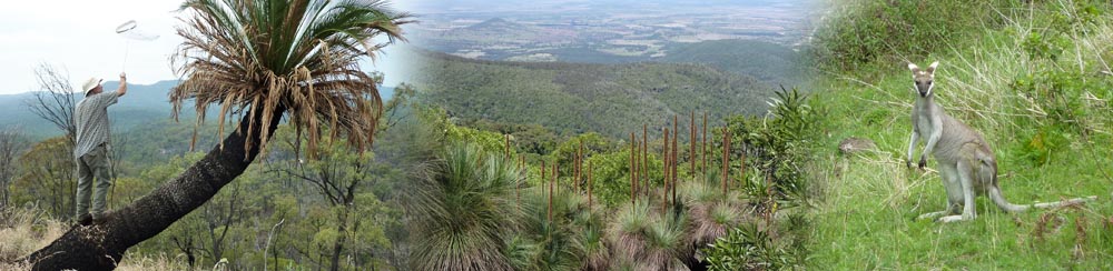
We decided early on to concentrate our efforts on collecting in national parks, since these contain among the best undisturbed habitats on the continent and good access. Our time was limited so we chose a route through eastern New South Wales and southern Queensland (Fig. 1) that would encompass coastal and inland sites and habitats ranging from sand dunes to eucalypt forests to wet and dry rainforests. We planned to split up our team, with Pierfilippo and Jim arriving first and collecting for a week in New South Wales. They would then meet up with John and Isaac in Queensland and the four would collect together for the next nine days. Pierfilippo and Jim would leave and John and Isaac would continue collecting for a few more days before also departing. Collecting and export permits were arranged as needed.
What follows below is a list of sites where we collected tachinids in Australia. Some descriptive information is given about most of the sites. Images are included for many of the sites; click on the thumbnail image for a larger view.
Also given below are lists of tachinid taxa collected during our trip. This content is being added incrementally as we sort through our material and identify what we caught. We expect to see the most change taking place on this page during the first half of 2014. To see when this webpage was last updated, check the date given at the bottom of the page.
A review of this trip will appear in issue 27 of The Tachinid Times (2014).
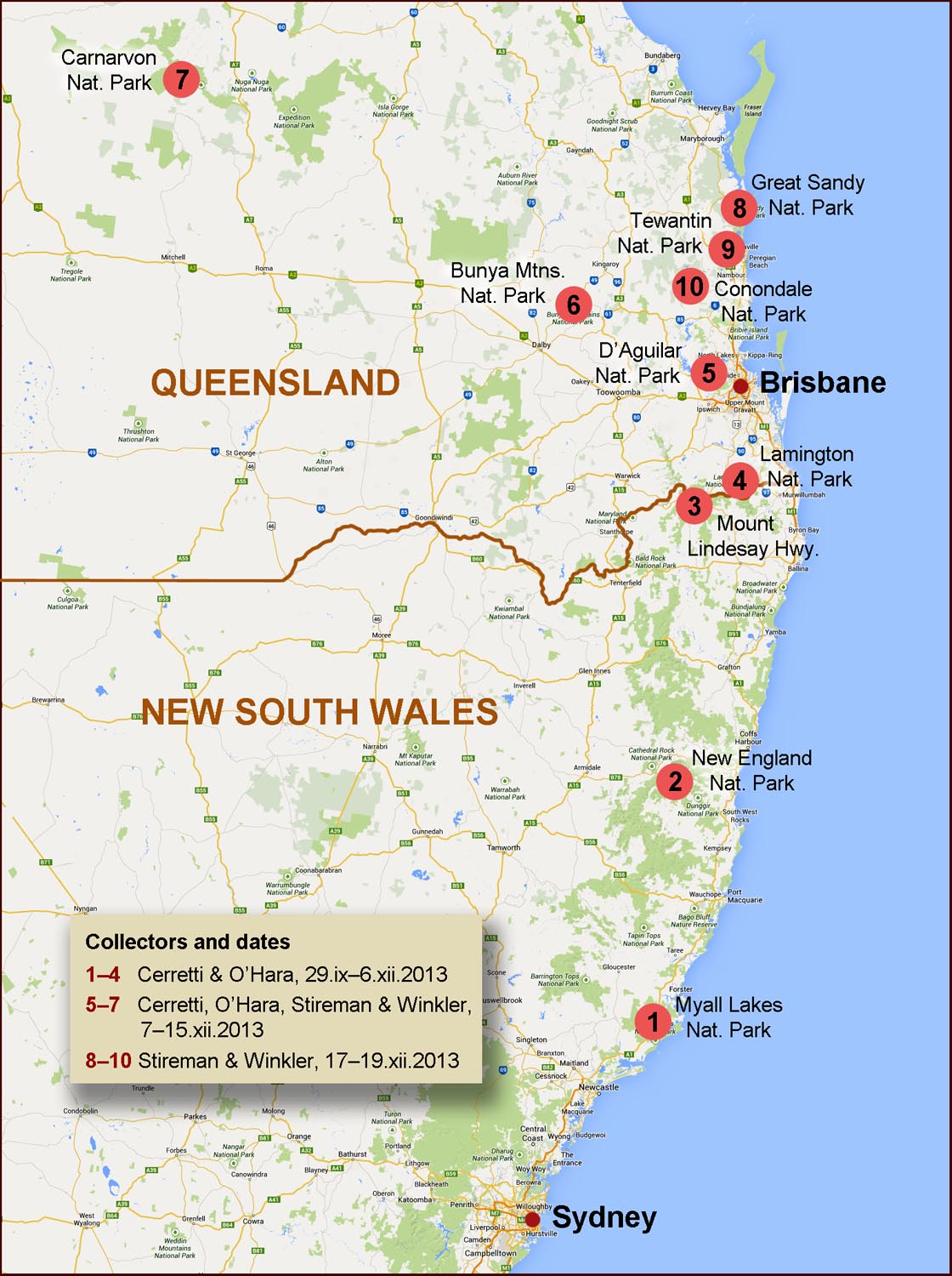
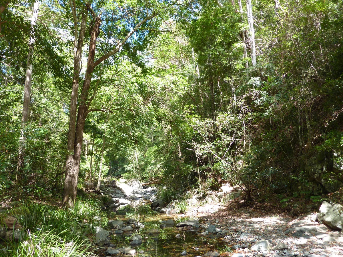
Australia, New South Wales, Myall Lakes National Park, Dark Point, 32°35.61'S 152°16.10'E, 4m, 29.xi.2013, P. Cerretti & J.E. O’Hara
Our first four days out of Sydney were spent exploring different habitats within Myall Lakes National Park. This park is situated about 200 kilometres north of Sydney and encompasses 47,500 hectares of lakes, coastal sand dunes, wetlands, eucalypt forest, and wet and dry rainforest. We were not able to fully appreciate this phenomenally diverse park because the weather was mostly overcast and tachinids were as a consequence less conspicuous. Nevertheless, we did manage to catch some key taxa for our project.
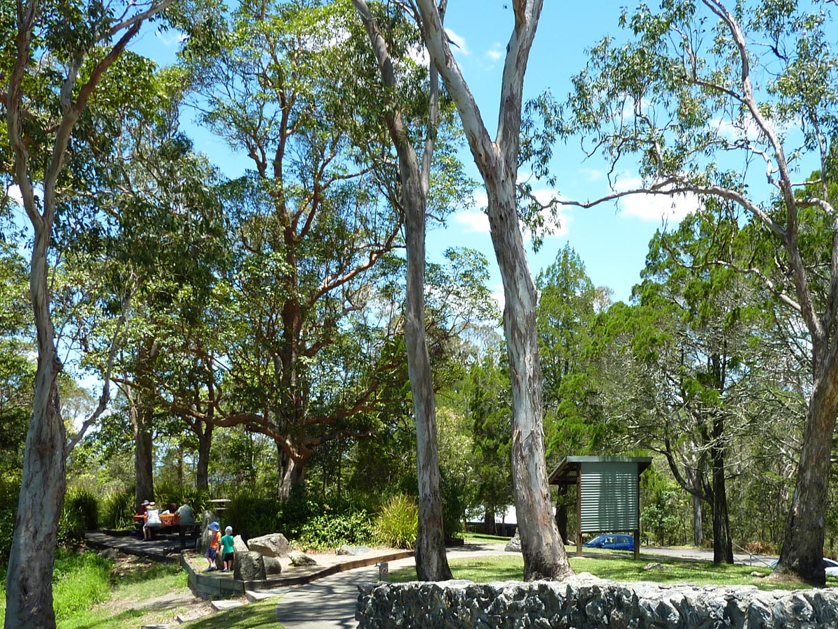
Australia, New South Wales, Myall Lakes National Park, O'Sullivans Gap, 32°20.63'S 152°15.59'E, 28m, 29.xi.–1.xii.2013, P. Cerretti & J.E. O'Hara
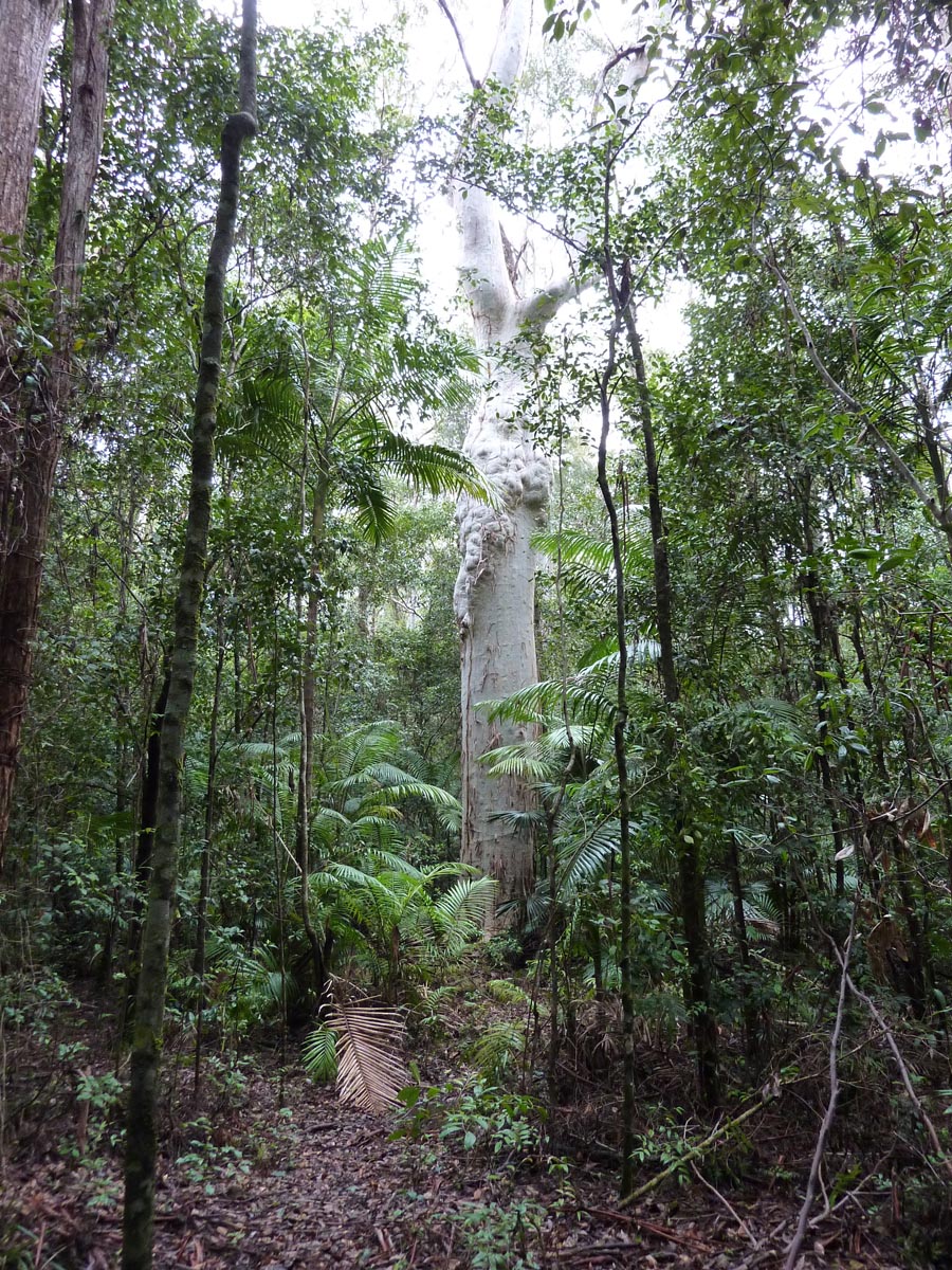
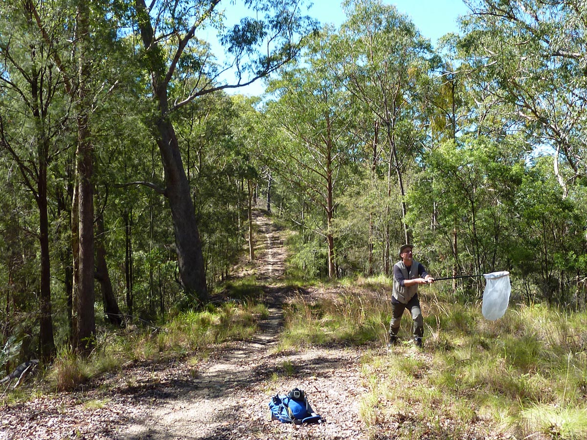
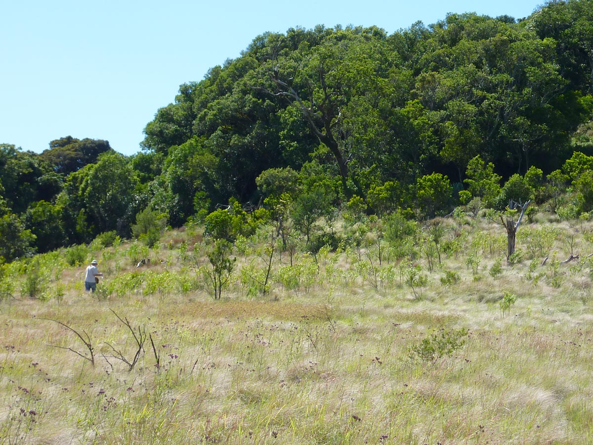
O'Sullivans Gap picnic area is a flat grassy place directly off Wootton Way highway. The picnic area is part of O'Sullivans Gap Flora Reserve, which in turn is part of Myall Lakes National Park. The picnic area is dominated by towering gum trees and bordered by dense rainforest. A 30-minute trail starts and ends at the picnic area and winds through both wet and dry rainforest. The trail was so wet on the day we followed it that we had to stop every minute or two to pull land leeches from our boots to prevent them from reaching bare skin. On a drier day the leeches had mostly disappeared from the trail. The best collecting was along the edge of the forest bordering the picnic area.
At O'Sullivans Gap we were also after another fly that is not a tachinid: the enigmatic "McAlpine's fly", an unplaced and undescribed calyptrate fly that was discussed in a paper by Kutty et al. (2010). Aided by pictures and a list of characters supplied by Thomas Pape (Natural History Museum of Denmark, Copenhagen), we were successful in catching a few specimens of this special fly.

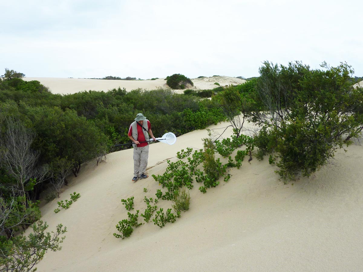
O'Sullivans Gap picnic area is a large grassy area with towering gum trees. The rainforest edge on the left was frequented by tachinids. P. Cerretti is in the background. (Photo: J. O'Hara)
Australia, New South Wales, Hawks Nest, 32°40.67'S 152°10.30'E, 3m, 30.xi.2013, P. Cerretti & J.E. O'Hara
Hawks Nest is a small community on the coast just south of Myall Lakes National Park. We stopped near here for a short time to collect on vegetation that was growing in sheltered pockets among the sand dunes next to the beach and ocean.
Australia, New South Wales, Myall Lakes National Park, Robinsons Fire Trail, 32°36.18'S 152°14.16'E, 8m, 30.xi.2013, P. Cerretti & J.E. O'Hara
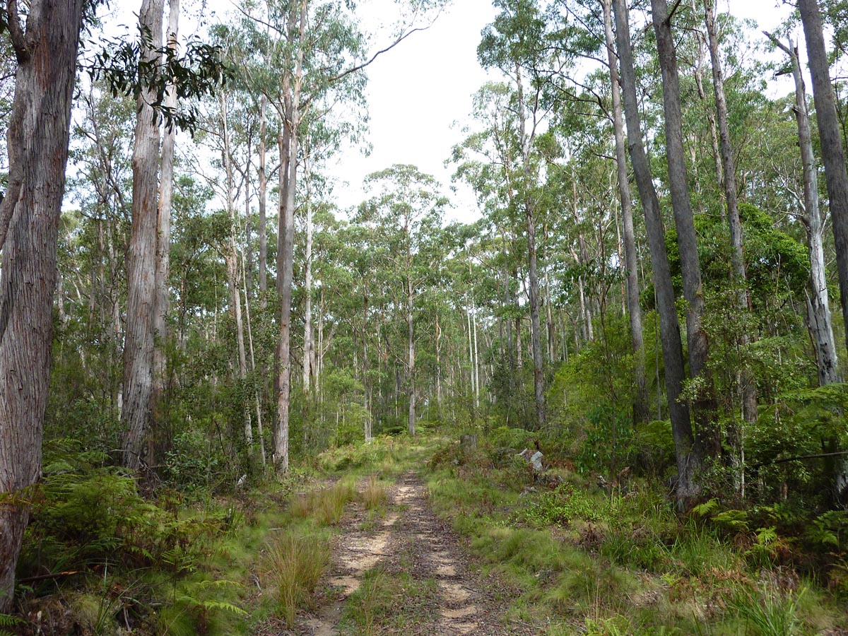
Robinsons Fire Trail is accessed from the Mungo Brush Road and runs through a eucalypt forest.
Australia, New South Wales, Myall Lakes National Park, Mungo Brush Road, 32°31.91'S 152°19.31'E, 18m, 30.xi.2013, P. Cerretti & J.E. O'Hara
At this location the Mungo Brush Road runs through a small area of rainforest.
Australia, New South Wales, Myall Lakes National Park, Grandis, 32°21.90'S 152°17.53'E, 14m, 1.xii.2013, P. Cerretti & J.E. O'Hara
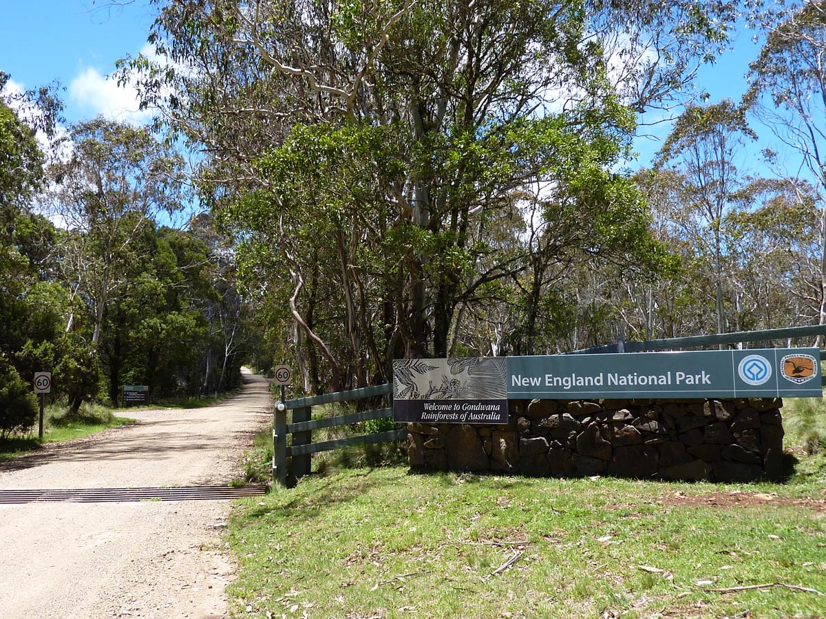
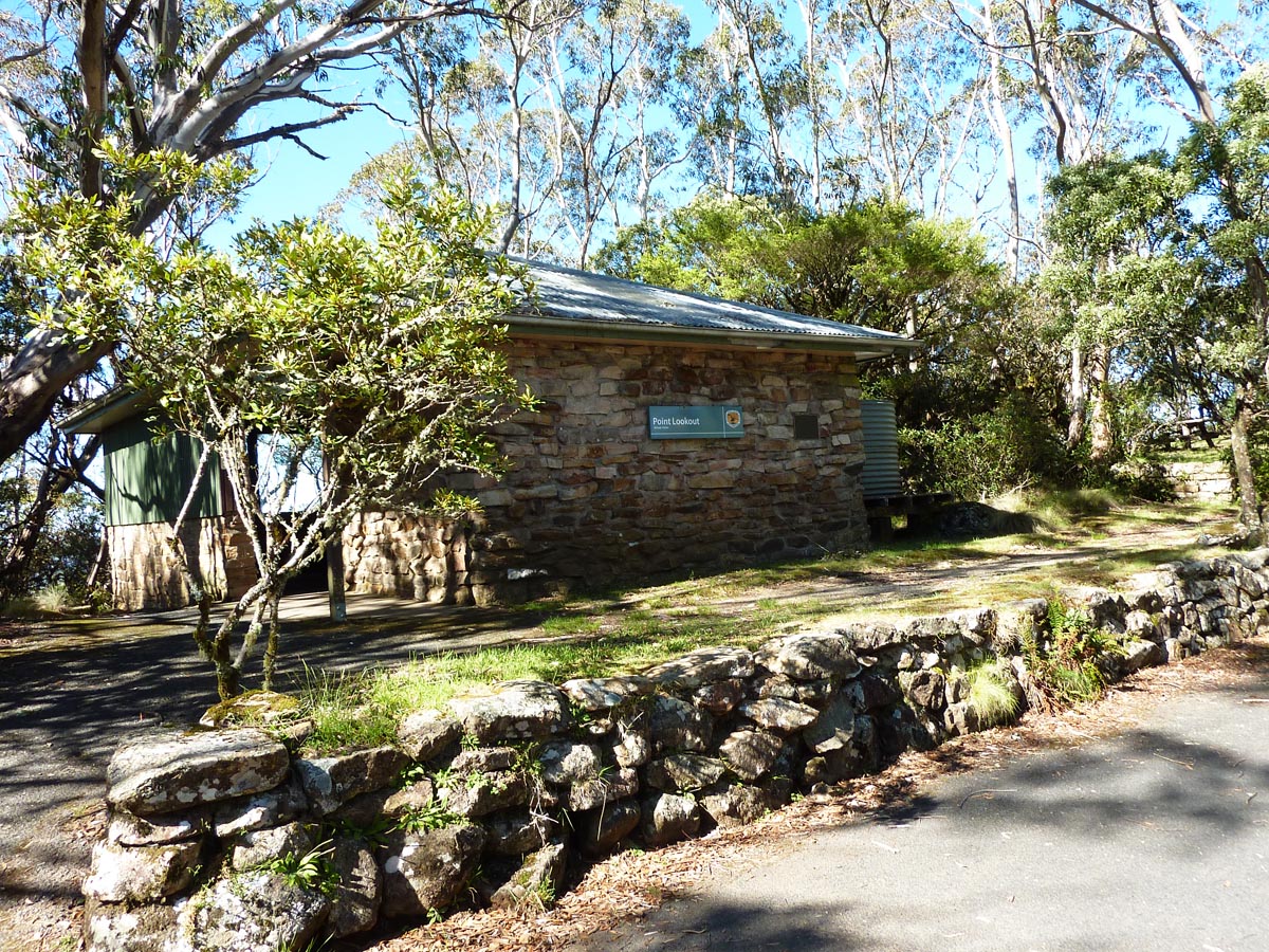
Australia, New South Wales, New England National Park, Point Lookout, 30°29.28'S 152°24.66'E, 1480m, 2–3.xii.2013, P. Cerretti & J.E. O'Hara
New England National Park was one of the highlights of our trip. It covers an area of about 72,000 hectares but seems larger because of its proximity to several other parks and protected areas. Situated in the New England Tablelands, it is best known for the precipitous cliffs that line the Great Escarpment. One particularly scenic spot along the cliffs has been developed into Point Lookout with a parking lot, picnic areas, and trails to overlooks. Despite this development, there is still plenty of natural vegetation and tachinids treat this high cliff-side site like a hilltop.
Monty Wood (Honorary Research Associate, Canadian National Collection of Insects, Ottawa) visited Point Lookout in late December of 2005 and was quick to tell us about its extraordinary tachinid fauna. He drew from memory a map of Point Lookout showing its major landmarks and a dozen or so places where he had caught particular tachinid taxa. We had no problem finding the landmarks but interestingly we did not see many of the tachinids noted by Monty at the places where he had found them. This was unexpected because hilltopping tachinids are highly species-specific in where they aggregate and this is constant year after year unless physical changes are made to a site. We had good collecting at Point Lookout but clearly not as good as Monty, maybe because we were there about three weeks earlier in the year or Monty happened to visit during an especially "good" year for tachinids.

Australia, New South Wales, New England National Park, Banksia Point, 30°29.56'S 152°24.42'E, 1440m, 3.xii.2013, P. Cerretti & J.E. O'Hara
Banksia Point is a short drive down the road from Point Lookout. Here exists a stand of Antarctic beech (Nothofagus moorei), a remnant of a cool temperate rainforest dating back to the supercontinent Gondwana when South America and Australia were physically and ecologically joined via Antarctica. The Antarctic beech forests of New England National Park are part of the Gondwana Rainforests of Australia World Heritage Area.
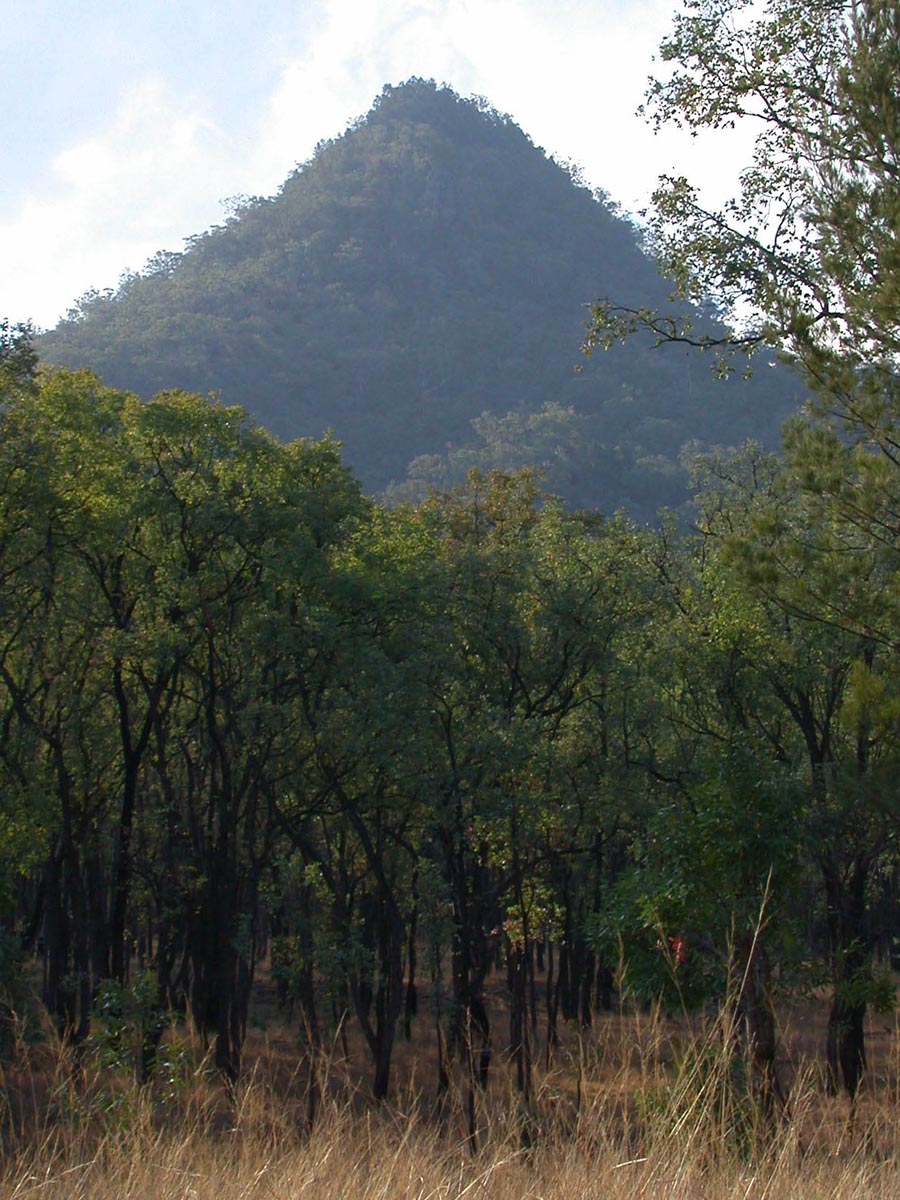
Australia, New South Wales, Cunnawarra National Park, hilltop, 30°40.76'S 152°12.34'E, 720m, 4.xii.2013, P. Cerretti & J.E. O'Hara
We were following the Armidale-Kempsey dirt road and came upon a hillside that our GPS map showed leading to a prominent hilltop. There was a steep off-road trail leading up the hill and we followed it on foot. The slope flattened out in places and here tachinids were accumulating, including hovering Rutilia, as if we were on a mini-hilltop. The summit had been cleared and sported three tall concrete towers bearing power lines. We caught some tachinids that landed on the sides of the towers (e.g., Chetogaster violacea Macquart and Palpostoma sp.) and from vegetation on the edge of the summit.
Australia, New South Wales, New England National Park, Bashers Road, 30°29.56'S 152°24.42'E, 1000m, 4.xii.2013, P. Cerretti & J.E. O'Hara
Australia, New South Wales, Mount Lindesay Hwy., near Queensland border, 28°20.13'S 152°41.07'E, 530m, 5.xii.2013, P. Cerretti & J.E. O'Hara
Australia, Queensland, O'Reilly's Rainforest Retreat, 28°13.87'S 153°08.21'E, at light, 930m, 5.xii.2013, P. Cerretti & J.E. O'Hara
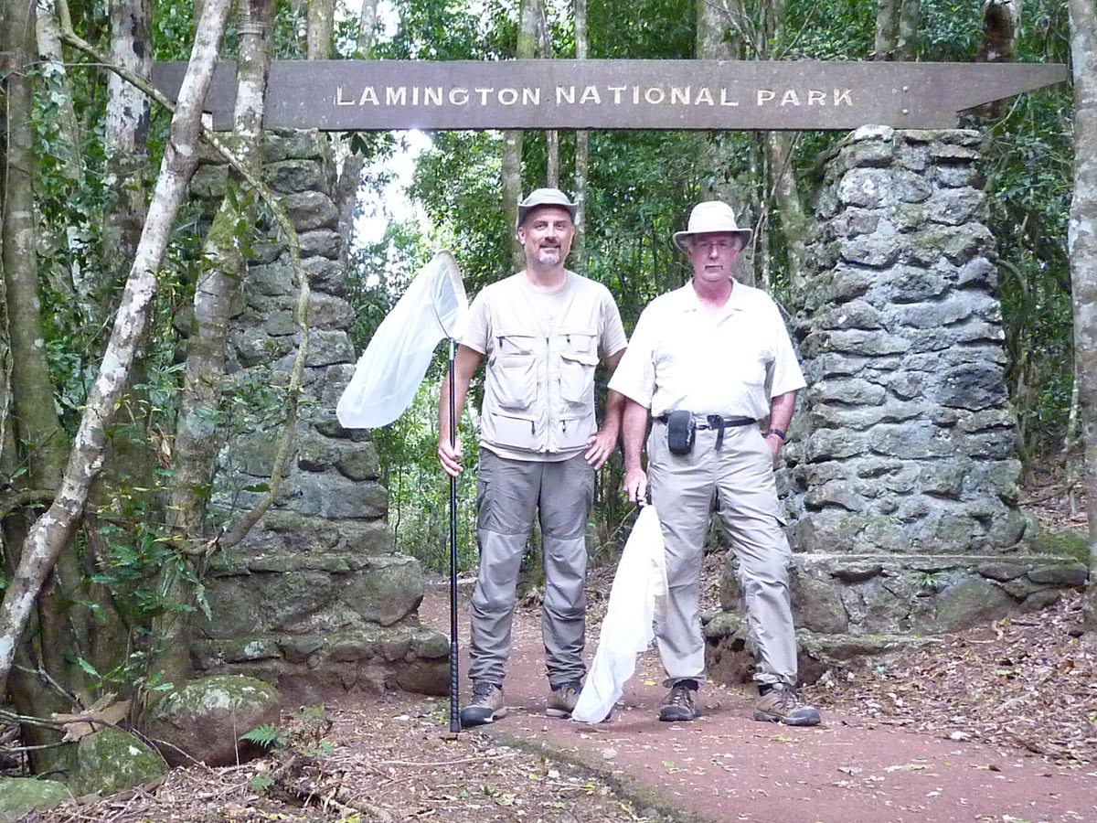
Lamington National Park is divided into the western Green Mountains Section and eastern Binna Burra Section. Both require a significant drive from the nearest towns and thus the best option, if one can afford it, is to seek accommodation within the park. This we did for one night, booking a room in O'Reilly's Rainforest Retreat deep within the Green Mountains Section of the park. The Retreat is on private land but is surrounded on all sides by Lamington National Park. Our decision to stay at the Retreat paid off as it allowed us to collect some specimens of a nocturnal tachinid (Palpostoma sp.) at lights after dark.
Australia, Queensland, Lamington National Park, along park road, 28°13.53'S 153°07.70'E, 890m, 6.xii.2013, P. Cerretti & J.E. O'Hara
We had only a morning of collecting at Lamington National Park because we were due in Brisbane later that day. This meant that we were confined to shorter hikes in the vicinity of O'Reilly's Rainforest Retreat and along the Lamington National Park Road. The rainforest was the most awe-inspiring we had seen so far but this was not matched by high numbers of tachinids and in the end we left the park with fewer key taxa than we had hoped for.

Australia, Queensland, D'Aguilar National Park, Scrub Road, 27°25.65'S 152°50.48'E, 230m, 7.xii.2013, P. Cerretti & J.E. O'Hara
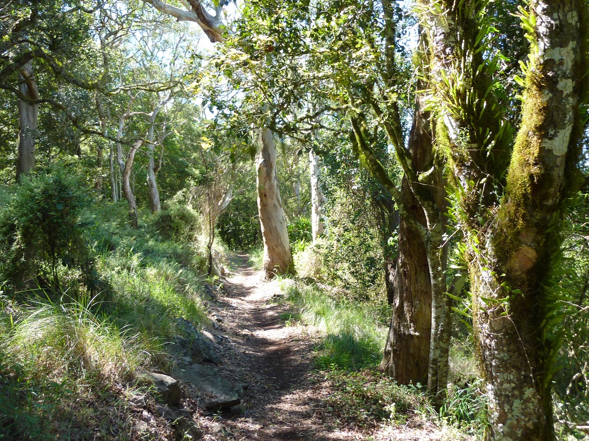
Scrub Road, a gated track, runs south through a eucalypt forest to a remote campsite about 4 km from Mount Nebo Road (Hwy. 31). Our destination was about 1.5 km down Scrub Road where the eucalypt forest changes to rainforest along the course of a small stream. Despite the appearance of good habitat, tachinids were exceedingly scarce.
(Photo: J. O'Hara)
Australia, Queensland, D'Aguilar National Park, Jolly's Lookout, 27°23.99'S 152°48.40'E, 490m, 7.xii.2013, P. Cerretti & J.E. O'Hara
D'Aguilar National Park is a narrow strip of parkland that straddles the rugged D'Aguilar Range and extends southeastward into the city of Brisbane. Despite its proximity to the city and its well-groomed lookouts and picnic areas, it is still home extensive tracts of natural eucalypt forest and rainforest. Running through the South D'Aguilar Section of the park is Mount Nebo Road. After collecting along Scrub Road we drove northwestward along Mount Nebo Road stopping along the way at lookouts and other promising-looking places. Jolly's Lookout was the best of these for tachinids, attracting some hilltopping species.
John and Isaac reached Brisbane on this day and within hours started collecting in the Mount Mee Section of the park. The four of us would meet that evening at a motel in the small town of Kilcoy, a few hours' drive from our next destination, Bunya Mountains National Park.
Australia, Queensland, D'Aguilar National Park, Boombana, 27°24.13'S 152°47.55'E, 490m, 7.xii.2013, P. Cerretti & J.E. O'Hara
Australia, Queensland, D'Aguilar National Park, Westridge Lookout, 27°21.82'S 152°45.58'E, 500m, 7.xii.2013, P. Cerretti & J.E. O'Hara
Australia, Queensland, D'Aguilar National Park, Somerset Lookout, 27°05.475'S 152°39.803'E, 7.xii.2013, J.O. Stireman & I. Winkler
Australia, Queensland, D'Aguilar National Park, Western Escarpment Forest Drive, at creek, 27°06.012'S 152°40.397'E, 7.xii.2013, J.O. Stireman & I. Winkler
Australia, Queensland, D'Aguilar National Park, Mill Rainforest Walk, creek below car park, 27°04.830'S 152°42.497'E, 7.xii.2013, J.O. Stireman & I. Winkler
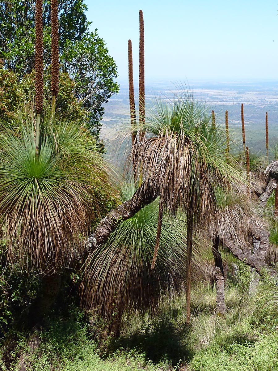
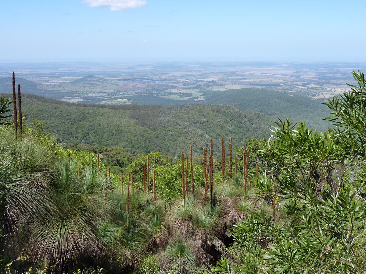
Australia, Queensland, Bunya Mountains National Park, Mt. Kiangarow & trail, 26°49.87'S 151°32.93'E, 1150m, 8.xii.2013, P. Cerretti, J.E. O'Hara, J.O. Stireman & I. Winkler
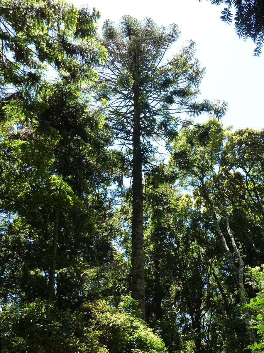
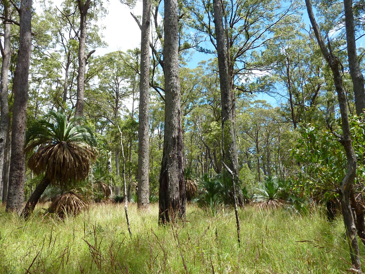
Bunya Mountains National Park covers about 12,000 hectares and encompasses most of the Bunya Mountains. This isolated portion of the Great Dividing Range is northwest of Brisbane and about 150 kilometres inland from the coast. In addition to its eucalypt and rainforest habitats, this park is especially noted for its bunya pines (Araucaria bidwillii) with dome-shaped crowns (and near-lethal 10-kilogram cones the size of watermelons) and unusual-looking grass trees (Xanthorrhoea glauca glauca).
Australia, Queensland, Bunya Mountains National Park, near Westcott camping area, 26°51.8'S 151°34.3'E, 1070m, 8.xii.2013, P. Cerretti, J.E. O'Hara, J.O. Stireman & I. Winkler
Throughout the Bunya Mountains are small areas of natural grassland known as 'balds'. These balds are recognized as forming an ecologically sensitive and endangered ecosystem that harbours a fragile fauna and flora.
Australia, Queensland, outside Bunya Mountains National Park, near Dandabah, 26°52.74'S 151°36.26'E, 1000m, 8.xii.2013, P. Cerretti, J.E. O'Hara, J.O. Stireman & I. Winkler
Australia, Queensland, outside Bunya Mountains National Park, near Dandabah, 26°52.74'S 151°36.26'E, at light, 1000m, 8–9.xii.2013, P. Cerretti, J.E. O'Hara, J.O. Stireman & I. Winkler
We spent two nights in a remarkably affordable fully-equipped cottage on the edge of Bunya Mountains National Park. At night, nocturnal tachinids were attracted to the outdoor lights of our cottage.
Australia, Queensland, Bunya Mountains National Park, trail from Westcott camping area, 26°52.0'S 151°34.2'E, 1070m, 9.xii.2013, P. Cerretti, J.E. O'Hara, J.O. Stireman & I. Winkler
Australia, Queensland, Bunya Mountains National Park, Koondaii Lookout, 26°51.74'S 151°33.70'E, 9.xii.2013, J.O. Stireman & I. Winkler
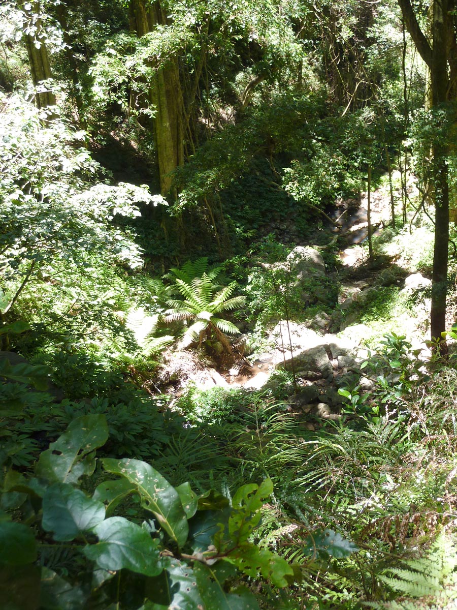
Australia, Queensland, Bunya Mountains National Park, trail to Little Falls, 26°52.3'S 151°34.7'E, 1040m, 9.xii.2013, P. Cerretti, J.E. O'Hara, J.O. Stireman & I. Winkler
A trail through beautiful rainforest leads to several waterfalls and lookouts.

Australia, Queensland, Bunya Mountains National Park, Mt. Kiangarow, 26°49.83'S 151°32.94'E, 9.xii.2013, J.O. Stireman & I. Winkler
Australia, Queensland, Mt. Moffat Road, northwest of Injune, 25°17.45'S 148°0.33'E, 10.xii.2013, P. Cerretti, J.O. Stireman & I. Winkler
Injune is the last town on the way to the Mt. Moffatt section of Carnarvon National Park. The route from Injune to the park is about 120 kilometres, much of it consisting of a well-maintained dirt road. Although the road is not a problem when dry, it can become impassable for days at a time after especially heavy rains. Both of our vehicles were 4WD and one had a 150-litre gas tank to give us an added sense of security and greater range while in the park.
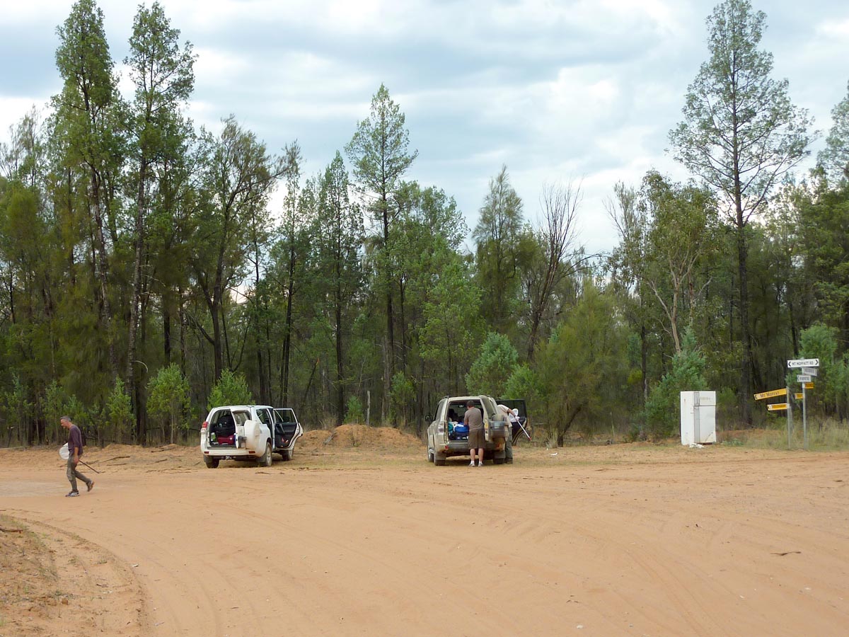
Australia, Queensland, Carnarvon National Park, Mt. Moffatt Section, barracks, 25°01.23'S 147°57.13'E, at light, 730m, 10–13.xii.2013, P. Cerretti, J.E. O'Hara, J.O. Stireman & I. Winkler
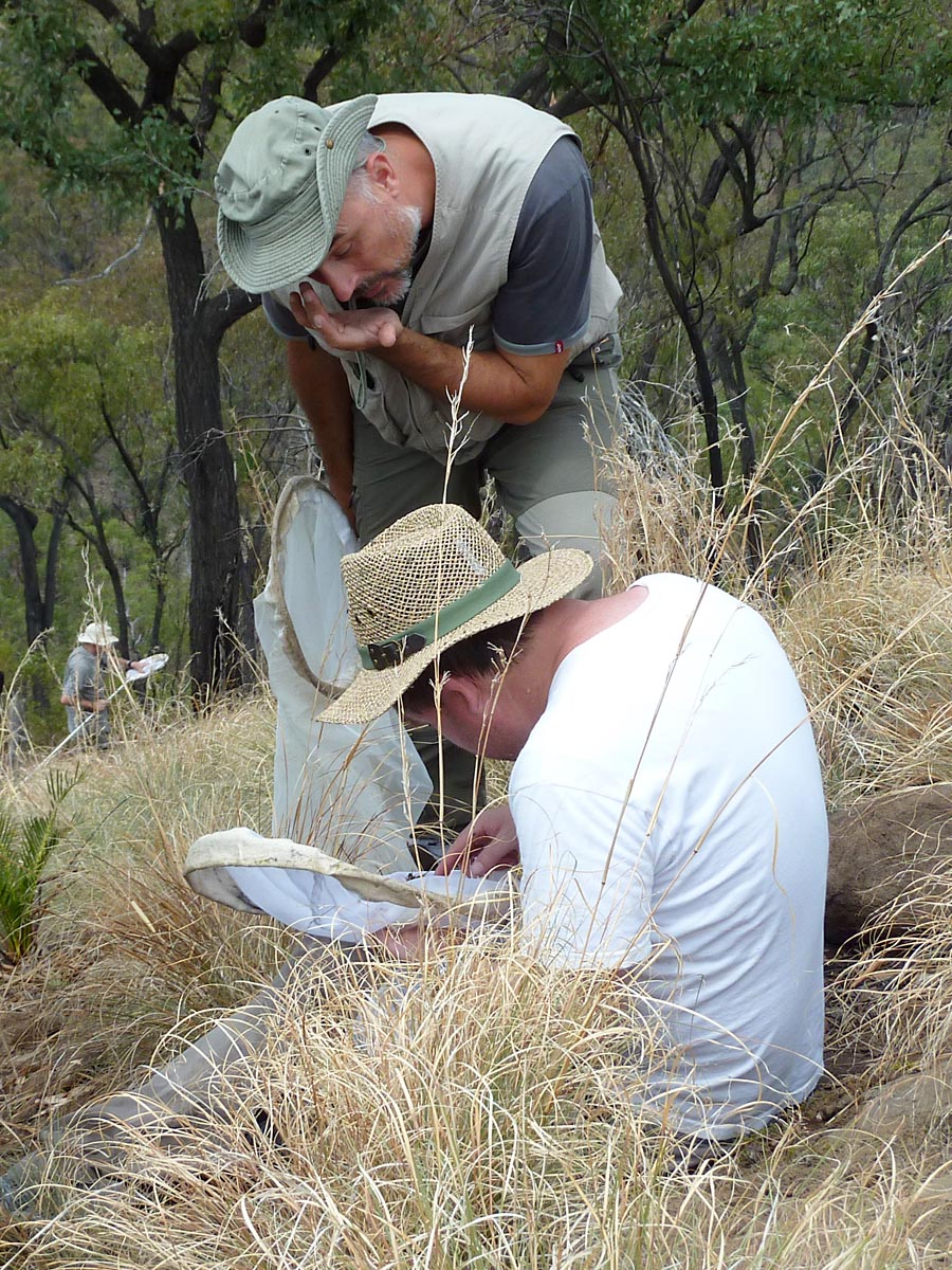
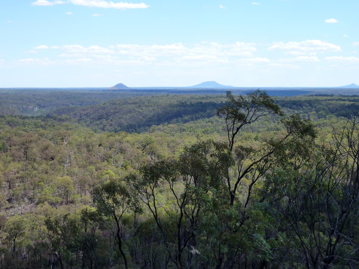
Carnarvon National Park was our most anticipated destination and the one at which we were hoping for the greatest tachinid diversity. The park did not disappoint. It is located about 600 kilometres northwest of Brisbane in the Central Queensland Sandstone Belt. Vast in size – almost 300,000 hectares – the park is also exceptionally diverse ecologically. We were here to visit two of the four sections: the remote Mt. Moffatt Section and the popular Carnarvon Gorge Section. Our primary interest was in the former because of its status as the best tachinid hilltopping location in Australia. This section of the park does not attract a lot of visitors and we did not see other people here except for rangers during our five-day stay.
We gladly accepted the offer of Greg Keith, Ranger in Charge of Mt. Moffatt Section, to stay in the well-equipped barracks next to the ranger's house during our visit to this section of the park. This was the same place where Jim stayed during his visit to Carnarvon in 2002, although the barracks have since been enlarged.

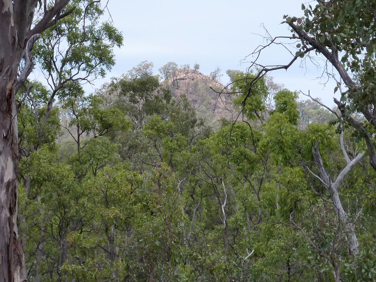
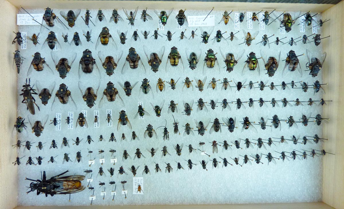
Australia, Queensland, Carnarvon National Park, Mt. Moffatt Section, "Fly Hill", summit, 24°58.36'S 147°59.63'E, 900m, 11.xii.2013, P. Cerretti, J.E. O'Hara, J.O. Stireman & I. Winkler; also 13.xii.2013, J.E. O'Hara
This small conical hill, barely visible from the nearest road a kilometre away, got is name when ranger Craig Eddy noted the abundance of flies at its summit in 2002 and nicknamed it Fly Hill. Dipterists visiting the park in October of the same year followed-up on this observation by collecting on Fly Hill and discovered it to be the best tachinid hilltopping site they had ever visited (see Hansen 2003, O'Hara 2003, O'Hara et al. 2004). It was again remarkably diverse in 2013, but not to the same extent as in 2002. Fly Hill was visited on December 11th by the four of us and on December 13th by Jim alone (the others spending the 13th on Mt. Moffatt).

Australia, Queensland, Carnarvon National Park, Mt. Moffatt Section, trail to The Tombs, 25°05.2'S 147°52.0'E, 12.xii.2013, P. Cerretti, J.E. O'Hara, J.O. Stireman & I. Winkler
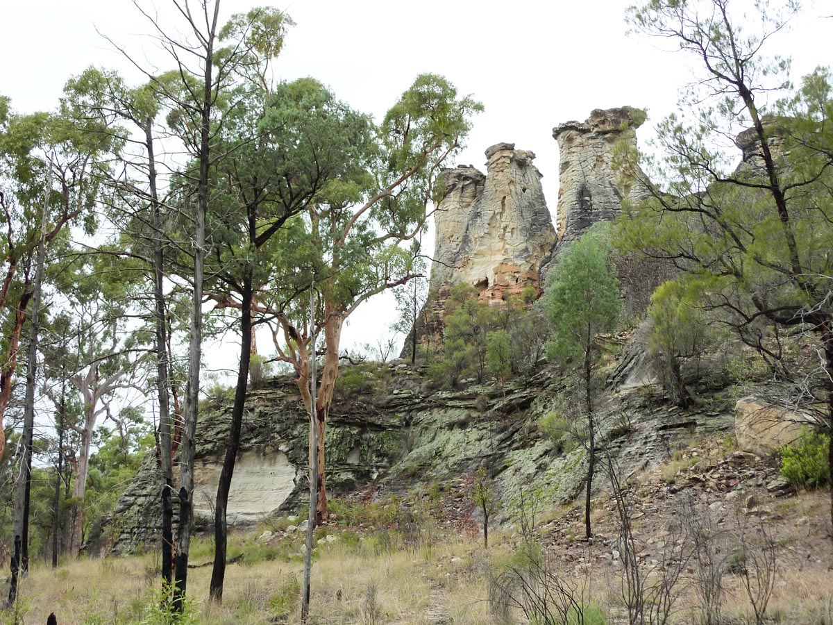
The sandstone bluff known as The Tombs was used by Aboriginal people as a burial site for their dead for thousands of years. The human remains have been plundered from the site, but the area continues to be sacred to the Aboriginal people. We followed a marked trail through the area but the day was overcast with periods of light rain and few tachinids were seen.
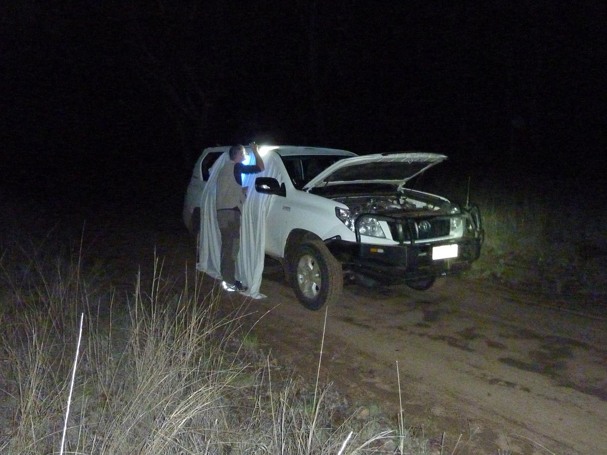
Australia, Queensland, Carnarvon National Park, Mt. Moffatt Section, 25°02.66'S 147°54.12'E, blacklight on road, 700m, 12.xii.2013, P. Cerretti, J.E. O'Hara, J.O. Stireman & I. Winkler
Australia, Queensland, Carnarvon National Park, Mt. Moffatt Section, hilltop west of road, 24°59.04'S 147°57.69'E, 940m, 13.xii.2013, J.E. O'Hara
Australia, Queensland, Carnarvon National Park, Mt. Moffatt Section, route to "Fly Hill", 24°58.04'S 147°59.60'E, 900m, 13.xii.2013, J.E. O'Hara
Australia, Queensland, Carnarvon National Park, Mt. Moffatt Section, Mount Moffatt, summit, 25°03.47'S 148°02.66'E, 1060m, 13.xii.2013, P. Cerretti, J.O. Stireman & I. Winkler
Australia, Queensland, Carnarvon National Park, Mt. Moffatt Section, Top Shelter Shed, 24°54.57'S 148°02.55'E, 1220m, 14.xii.2013, P. Cerretti, J.E. O'Hara & I. Winkler
Top Shelter Shed is located high on a plateau, the Consuelo Tableland.
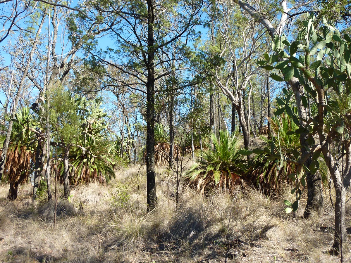
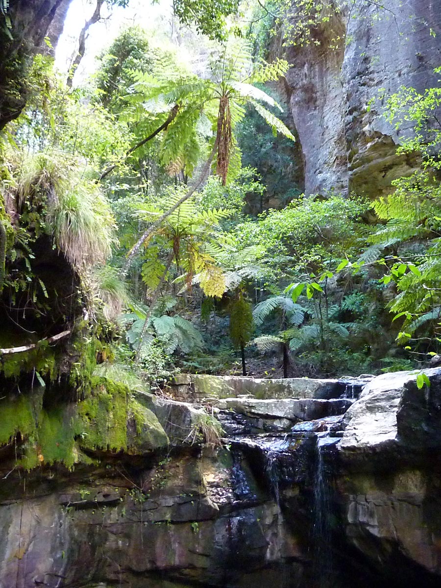
Australia, Queensland, Carnarvon National Park, Mt. Moffatt Section, Mahogany Forest, 24°55.54'S 148°03.85'E, 1215m, 14.xii.2013, P. Cerretti, J.E. O'Hara & I. Winkler
Cool and moist conditions support the lush Mahogany Forest, which is also on the Consuelo Tableland.
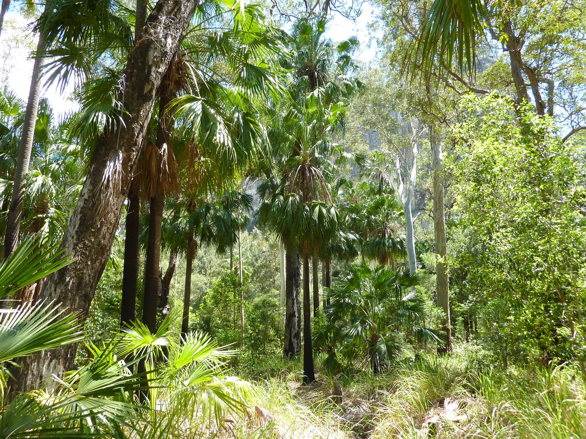
Australia, Queensland, Carnarvon National Park, Carnarvon Gorge trail, 25°02.7'S 148°12.2'E, 470m, 15.xii.2013, P. Cerretti, J.E. O'Hara, J.O. Stireman & I. Winkler
The eastern portion of Carnarvon National Park, the Carnarvon Gorge Section, is popular among tourists because of easy access, good trails, and spectacular views. There are surely many tachinids here but without clear aggregation sites they are hard to find, at least with only one day of collecting available. Jim and Isaac spent the day collecting deep into the Gorge along the main trail, whereas Pierfilippo and John went first to Boolimba Bluff before also collecting along the Gorge trail. There was hope that Boolimba Bluff would be a perfect spot for hilltopping but it proved disappointingly unattractive to tachinids.

Australia, Queensland, Tin Can Bay, motel, 25°55.53'S 153°00.58'E, at light, J.O. Stireman & I. Winkler
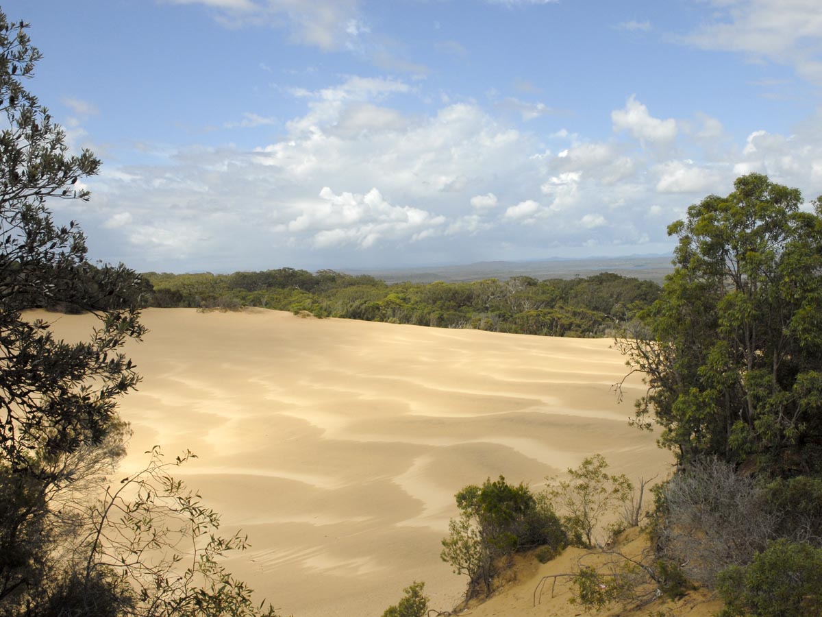
Australia, Queensland, Great Sandy National Park, Carlo Sandblow, 25°54.84'S 153°05.91'E, 17.xii.2013, J.O. Stireman & I. Winkler
Great Sandy National Park is a coastal park of sand dunes, scrubby woodland and rainforest. It consists of two sections, the Fraser Island Section (at 56,000 ha, apparently the world's largest sand island and a very popular tourist destination) and the mainland Coloola Section (over 18,000 ha, and part of the larger 61,750 ha Coloola Recreation Area), which we visited. The coastal forest and "sandblows" were impressive and beautiful, but yielded few tachinids.
Australia, Queensland, Great Sandy National Park, Bymien Picnic Area, 25°57.25'S 153°06.27'E, 17.xii.2013, J.O. Stireman & I. Winkler
The Bymien Picnic Area is a more inland rainforest area. The forest was impressive, with large buttressed trees and strangling figs reminiscent of forest we had seen in the Neotropics. One plant we were especially struck by was a vining bamboo-like plant (Flagellaria indica), which reached at least 10 m up into the canopy by attaching itself to other plants with stiff, tightly coiled leaf tips. Despite intermittent showers and our relatively late arrival, we managed to collect a few tachinids in sunlit tree fall gaps and along trails.
Australia, Queensland, Tewantin National Park, Mt. Tinbeerwah, 26°23.41'S 152°58.53'E, 18.xii.2013, J.O. Stireman & I. Winkler
Mt. Tinbeerwah has a good reputation among tachinid collectors in Queensland for several reasons: first, it is close to Brisbane, second, you can drive nearly to the top (one has to walk only a kilometer or so to the summit), and third, because there are lot of tachinids there! The summit of Mt. Tinbeerwah is primarily solid rock, with low vegetation in a few places with sufficient soil, and a few areas of short, shrubby trees. The observation tower that sits on the peak has great views of the surrounding valleys and hills and is a popular spot for sightseers. The day that we visited was not ideal, with some cloudiness and howling winds, yet we still were able to collect a fairly diverse array of tachinids, including some nice Rutilia and several taxa of Parerigonini. The best collecting was not on the observation tower itself as we had heard, but in the lower rocky areas around the tower – perhaps because of the fierce winds. We can only imagine how good this spot might be for collecting on a sunny, still morning.
Australia, Queensland, Conondale National Park, Booloumba Creek, campground, 26°38.37'S 152°38.78'E, 18–19.xii.2013, J.O. Stireman & I. Winkler
Australia, Queensland, Conondale National Park, Booloumba Creek, campground, 26°38.37'S 152°38.78'E, at light, 18.xii.2013, J.O. Stireman & I. Winkler
Australia, Queensland, Conondale National Park, Mt. Allan, 26°38.39'S 152°38.07'E, 19.xii.2013, J.O. Stireman & I. Winkler
Conondale National Park is a moderate-sized (35,500 ha) mountain park encompassing the Conondale Mountain Range, somewhat similar in size and vegetation to Bunya Mountains National Park (even boasting the characteristic bunya pines of the latter). The park was very pleasant and scenic, with clear cool streams, diverse forests, and rounded mountain tops. Our main collecting event in the park was on the top of Mt. Allan. A 7 km or so hike took us to the top of this local peak, which was fairly large and broadly rounded. Although ringed by trees, in the center of the summit there was a clearing where vegetation had been replaced with a large fire tower. Unfortunately the fire tower was under repairs and access was closed. The collecting was nothing like Mt. Moffat, but there were tachinids here and there, and we spent several hours patrolling key bushes and grassy hillocks along the top. Perhaps our best find was Myiotrixa prosopina Brauer & Bergenstamm (Myiotrixini), individuals of which were perching on a utility pole near the top.
References
Cerretti, P., O'Hara, J.E., Stireman, J.O. III, Winkler, I.S. and Kirk-Spriggs, A.H. 2013. To 'Die Hel' and back. Expeditions of the Phylogeny of World Tachinidae Project. Part I: Western Cape, South Africa. The Tachinid Times 26: 20–29.
Crosskey, R.W. 1973. A conspectus of the Tachinidae (Diptera) of Australia, including keys to the supraspecific taxa and taxonomic and host catalogues. Bulletin of the British Museum (Natural History). Entomology Supplement 21: 221 pp.
Hansen, D.E. 2003. Notes on tachinids in copula from hilltops in Carnarvon N.P., Queensland, Australia. The Tachinid Times 16: 3–5.
Kutty, S.N., Pape, T., Wiegmann, B.M. and Meier, R. 2010. Molecular phylogeny of the Calyptratae (Diptera: Cyclorrhapha) with an emphasis on the superfamily Oestroidea and the position of Mystacinobiidae and McAlpine's fly. Systematic Entomology 35: 614–635.
O'Hara, J.E. 2003. The tachinid fauna of Carnarvon National Park, Queensland, as revealed by hilltop collecting. The Tachinid Times 16: 5–8.
O'Hara, J.E., Skevington, J.H. and Hansen, D.E. 2004. A reappraisal of tachinid diversity in Carnarvon N.P., Australia, and estimation of the size of the Australian Tachinidae fauna. The Tachinid Times 17: 8–10.
Stireman, J.O. III, O'Hara, J.E., Moulton, K., Cerretti, P. and Winkler, I.S. 2013. Progress towards a phylogeny of world Tachinidae. Year 1. The Tachinid Times 26: 4–9.
